
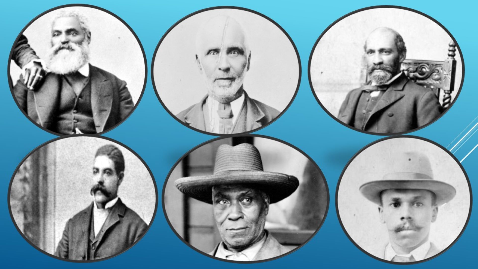
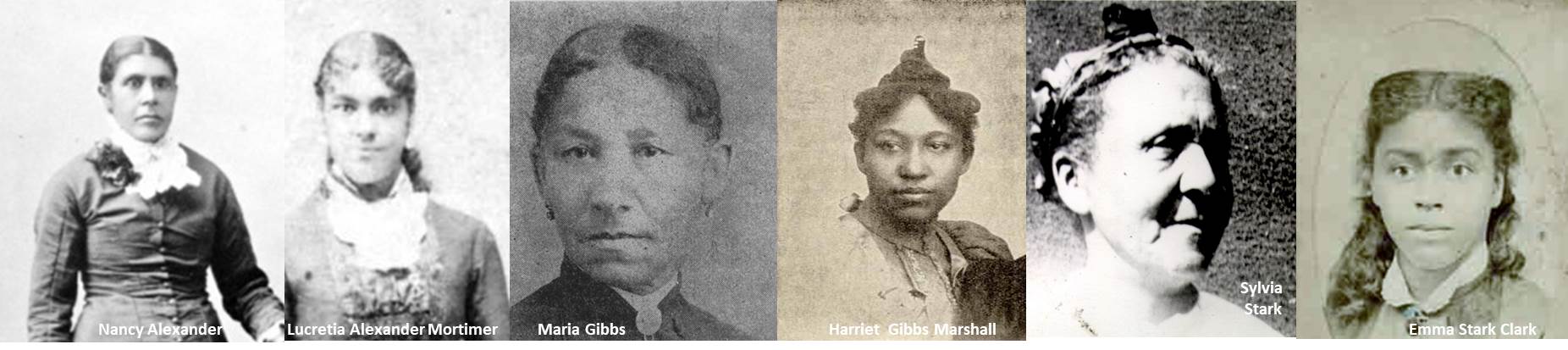
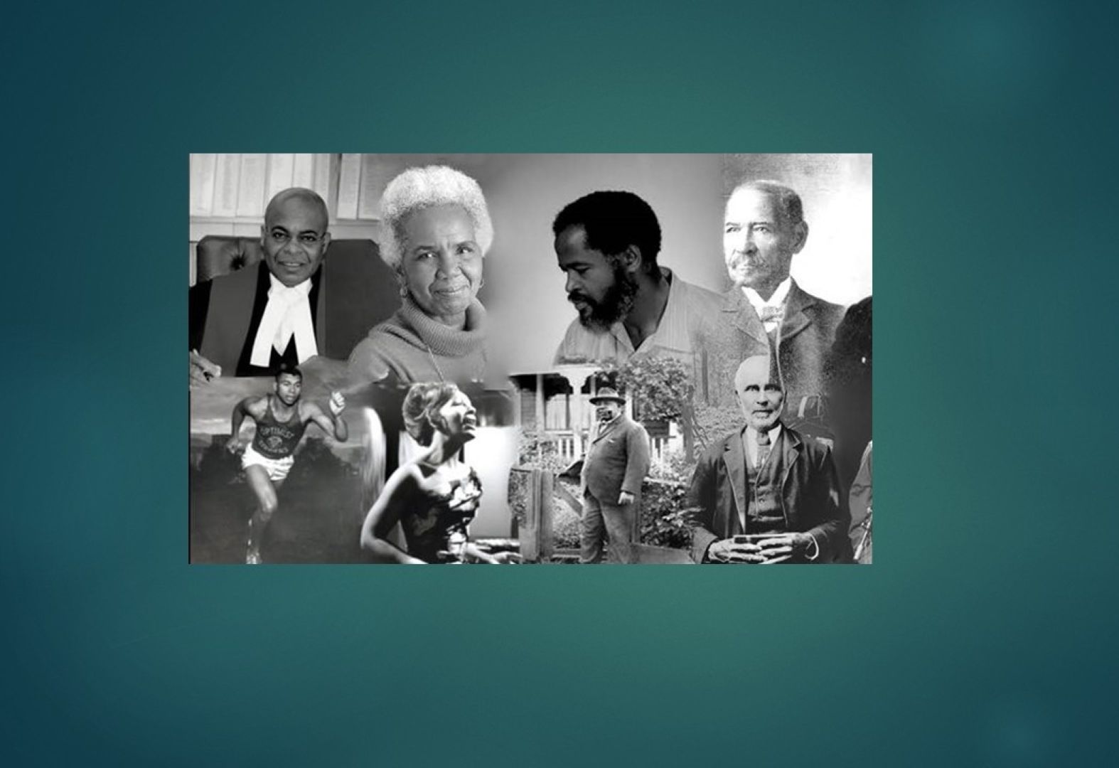
Learn about these places, spaces, and landscapes that underscore the achievements and contributions of the first 1858 pioneers, their descendants, and the incomers and immigrants of African heritage who have chosen to make their home here.
| Snapshot | Details | |
|---|---|---|
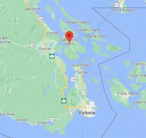
Victoria, south Vancouver Island, Nanaimo and Salt Spring Island | ||
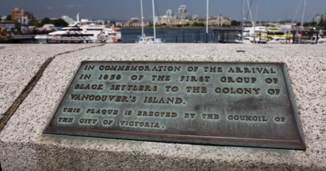
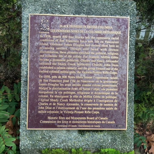
| City of Victoria Commemorates the Arrival of the Black Pioneers. This plaque is the 2nd in a series of 71 bronze plaques that line the Upper Causeway overlooking the Inner Harbour commemorating historic Victoria harbour events. The plaque reads "In Commemoration of the arrival in 1858 of the first group of Black settlers to the Colony of Vancouver's Island. This plaque is erected by the Council of the City of Victoria" This plaque was laid in August 1978. Read the story Why They Came and the Pioneer Committee | |
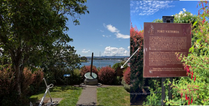
| Fort Victoria National Historic Site of Canada | |
On the right of this marker, just in front of the shrubbery, is the bronze plaque installed by the Historic Sites and Monuments Board of Canada. The plaque reads: “FORT VICTORIA. The mooring rings on the rocks below are the only surviving fragment of Fort Victoria built by the Hudson’s Bay Company in 1843. From Oregon Boundary was drawn the 49th parallel , this post served as grand depot and headquarters of the Company’s Pacific fur trade. Ships moored here to unload supplies for an extensive network of forts and to take on natural products for export, principally to Alaska, California and Hawaii. In 1849 the first Legislative Assembly of the Colony of Vancouver Island met in the fort. The last remaining buildings of Fort Victoria were dismantled in 1864.” | ||
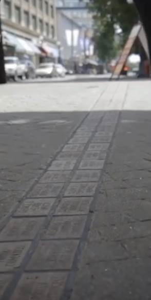
| Bastion Square and 1000 to 1150 Government Street. | |
The Bricks along Government Street are:
| ||
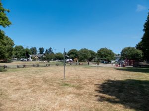 Alexander Park is located at 1300 block Bay St. at Oregon Ave. Coincidentally? it was the steamship Oregon that brought Charles and Nancy to Victoria in 1858. The park is family-friendly with grassy areas, picnic tables, playground, and has an off-leash area/time for dogs. | ALEXANDER PARK in 1300 block Bay St. at Oregon Ave., Victoria A direct descendant of Charles and Nancy Alexander tells us Alexander Park was named after Frederick Douglas Alexander and his wife Mary Louisa (nee Barnswell) Alexander, dedicated on Oct 15, 1980 by Alderman Sinclair, City of Victoria. Mary Louisa and Frederick grew up in Victoria, attended school, worked, raised their families, and were community advocates. They celebrated their golden wedding anniversary in 1944. Frederick died on October 3, 1950 and Mary Louisa on June 30, 1966.
| |
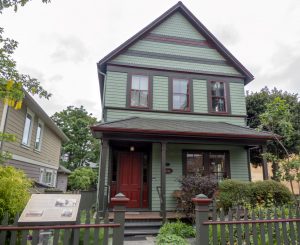 | Dandridge House, 1243 Rudlin Street, Victoria. | |
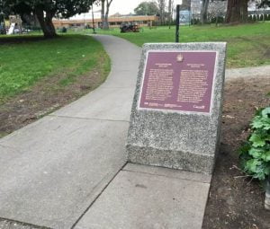 | Mifflin Wistar Gibbs Commemorative Plaque – Irving Park in James Bay, Victoria. | |
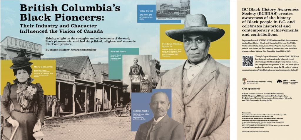
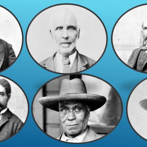
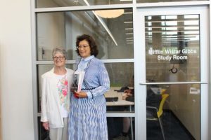 | The Mifflin Wistar Gibbs Study Room, opened in May 2018, a year before the plaque at Irving Park was unveiled. The Study Room is located in the sxʷeŋxʷəŋ təŋəxʷ James Bay Branch library at 385 Menzies Street diagonal to Irving Park. Dr. Verna Gibbs, great, great grandniece, officially opened the room. She is pictured here with then BCBHAS President, Mavis DeGirolamo. On June 11, 2022 the unveiling ceremony took place at the branch for this montage (below) installed in the study room. This montage is a tribute to the exhibit “British Columbia Black Pioneers: Their Industry and Character Influenced the Vision of Canada” This online exhibit was designed and developed by BCBHAS and is hosted by Digital Museums Canada. | |
| ||
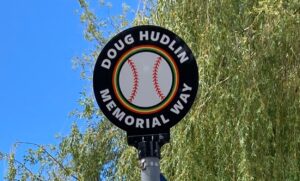 | "Doug Hudlin Memorial Way" | |
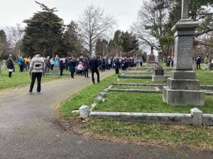 | Ross Bay Cemetery, 1516 Fairfield Rd. Victoria. | |
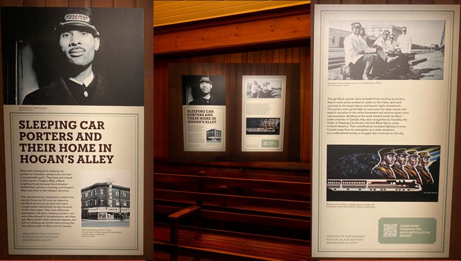 | Sleeping Car Porters Permanent Exhibit at Royal BC Museum in the “Old Town – New Approach” space. The exhibit opened in 2022, the panels were given a “new look" in September 2024. | |
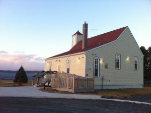
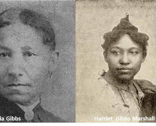
 | Central Saanich United Church formerly known as Shady Creek United Church 7180 West Saanich Road, Saanichton. In February 2024 this church was designated a Heritage Building by the District of Central Saanich. Grave markers for Charles and Nancy Alexander: In 2014 our Society partnered with Alexander Family descendants to restore their grave markers. The restored markers were unveiled at a ceremony held on August 16, 2014. | |
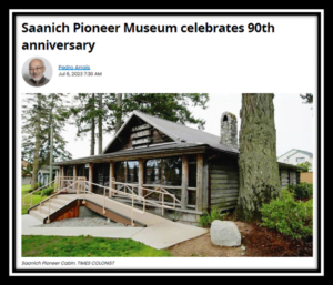
| Saanich Pioneer Museum 7910 Polo Park Crescent, Saanichton, B.C. Directions: The log cabin museum is located north of Victoria at 7910 Polo Park Crescent, Saanichton. (off the 7900 block of East Saanich Road, 2 blocks north of the Prairie Inn just behind Thrifty Foods Grocery.) July 2023- Read the Times Colonist article by Pedro Arrais about their 90th anniversary | |
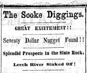 | Leechtown near Sooke on the west shore of Vancouver Island. | |
| Salt Spring Island Archives, 129 McPhillips Ave. Salt Spring Island. | |
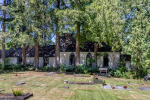
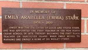 | Emily (Emma) Stark’s house 331 Wesley Street, Nanaimo. "In memory of Emily Arabella (Emma) Stark | |
| Stark’s Barn, 1526 Extension Road, Nanaimo. The image is the interpretive sign for Chase River Pioneers, with the barn in the background. Christine Meutzner, Nanaimo Community Archives manager. “There’s a Starks [railway] crossing near there, so I think it’s possible that people, by extension, just ended up calling it Stark’s barn. We’ve never been able to say definitively that was Stark’s barn. Nanaimo Heritage Register
| |
BC - Lower Mainland | ||
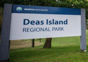
| Deas Island Regional Park. | |
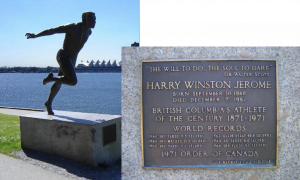 | Harry Jerome Statue and Plaque, Stanley Park, Vancouver.
| |
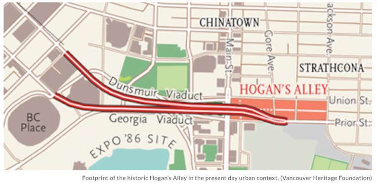
| Hogan's Alley ran through the southwestern corner of Strathcona in Vancouver during the first six decades of the twentieth century. “Hogan’s Alley was part of the ethnically diverse East End, centered between Prior and Union and Main and Jackson. It was home for many of Vancouver’s Black community and included businesses such as Vie’s Chicken and Steak House on Union and the Pullman Porters’ Club on Main. The neighbourhood was a popular cultural hub before mid-twentieth century urban renewal schemes and the Georgia Viaduct Replacement Project demolished many of its buildings.” Visit the Hogan's Alley website. Here you will find videos and stories that celebrate some of the remarkable people and places that made this community vibrant and unique. Image: Footprint of the historic Hogan's Alley in the present day context. Courtesy Vancouver Heritage Foundation.
| |
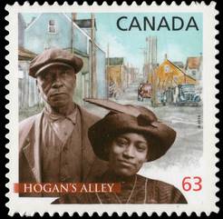 | This Hogan's Alley commemorative stamp was issued in 2014. William Spotts arrived as a child to Vancouver Island and grew up there on a farm with seven siblings. His father Fielding Spotts had been a school trustee. William moved to Strathcona and ran a shoe repair business on Main Street; his home was at 217½ Prior Street, seen in the background. Nora Hendrix, the grandmother of famed musician Jimi Hendrix, arrived circa 1912 was a community leader and a co-founder of Vancouver’s first Black church, the African Methodist Episcopal Fountain Chapel at Prior and Jackson Avenue. | |
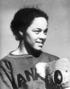 | Barbara Howard Plaza. | |
 | Rosemary Brown Park: Rosemary Brown (1930–2003) was an acclaimed community leader and elected representative. She was distinguished by many awards and recognition before and after being invested into the Order of Canada in 1996. Her earliest foray into provincial politics was in the 1972 provincial election. Rosemary Brown won the riding of Vancouver-Burrard, becoming the first Black woman to sit in the Legislative Assembly of British Columbia and the first Black woman elected to a provincial legislature in Canada. She served as an MLA for 14 years. This park was opened in 2005. In 2021 a new public school in the Durham District School board in Ajax, Ontario was named Rosemary Brown Public School. The Rosemary Brown Arena opened in Burnaby on May 11, 2024. | |
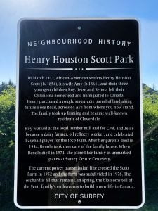 | Henry Houston Scott Park in Surrey In March 1912 African-American settlers Henry Houston Scott (b.1854), his wife Amy (b. 1864) and their three youngest children Roy, Jesse and Benola left their Oklahoma homestead and immigrated to Canada. Roy worked at the local lumber mill and for CPR and Jesse became a dairy farmer, oil refinery worker and celebratedbaseball player for the local team. After her parents died in 1934, Benola took over care of the house. When Benola died in 1971, she joined her family in unmarked graves at Surrey Centre Cemetery. The current power transmission line crossed the Scott farm in 1952 and the farm was subdivided in 1978. The orchard is all that remains. In spring the blossoms tell of the Scott family’s endeavours to build a new life in CanadaIn 2018 the City of Surrey installed a family grave marker at the Surrey Cemetery. | |
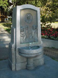
| Joe Fortes Memorial Drinking Fountain in the West End's Alexandra Park. Sculptor: Charles Marega. Created in 1927. Initially, Joe was recognized as the unofficial guardian of English Bay; in 1900, Joe became an official employee of the city. He is credited with saving at least 29 lives from drowning, as well as teaching three generations of Vancouver children to swim. On May 20, 1976, the Joe Fortes Branch of the Vancouver Public Library, 870 Denman Street was opened. In 1986 the Vancouver Historical Society formally declared Joe as “Vancouver Citizen of the Century”. Joe's story | |
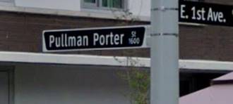 | Pullman Porter Street, Vancouver. | |
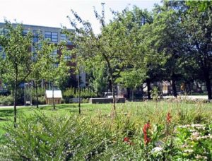
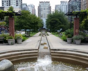 | Emery Barnes Park, 1100 Seymour Street, Vancouver. The Vancouver Park Board describes this .85 hectares as “an urban oasis”. The park amenities include promenades, quiet seating areas, water features, trees, lawn, flowers and shrubbery, playground and off-leash dog park. The park grounds were developed over a decade in three phases from 2002 to 2012 including a plaque in his honour.
| |
John Braithwaite Community Centre. | ||
BC - Lower Mainland | ||
 | Barkerville | |
Mount Clore and Clore River. Terrace Herald, January 30, 1963, p.4. “Old Timer’s Story As Displayed at Chamber of Commerce Convention”. Terrace Herald, July 24, 1968. P. 2. “Veteran Prospector Arthur Clore dies”. | ||
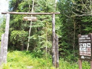 | Giscome Portage, Giscome Canyon and Giscome Rapids. Kilian, C. Go Do Some Great Thing (2nd edition). Pp. 125. “Giscome was born in Jamaica in 1832, was part of the migration in 1858. He prospected and mined in the mid and northern parts of B.C. He did well as a miner; he died at the age of 75 in 1907 and is buried in the Ross Bay Cemetery”. Read more about John Robert Giscome | |
McDame Creek Kilian, C, "Go Do Some Great Thing” , 2nd edition pp.124-125 "McDame Creek is located in the Cassiar land district of British Columbia. Henry McDame, a prospector in 1870, discovered the creek. The name McDame Creek was established by the Geographic Board of Canada in 1898. "Another gold discovery was made by McDame 90 miles from Deas Lake in 1874, and with a group of predominately Black miners, he formed The Charity Company."
| ||
| The Huble Homestead Historic Site located 40km north of Prince George; housed in an historic house, their artifacts and website includes content about Giscome and McDame. | ||
Other places of Interest - Canada and the United States | ||
 Africville Church (est. 1849), reconstructed in 2011 as part of the Africville Apology delivered on 24 February 2010 by the City of Halifax, Nova Scotia for the eviction and eventual destruction in 1970 of Africville | Africville, Nova Scotia | |
| Buxton National Historic Site & Museum, Ontario. Buxton was a terminus of the Underground Railroad, a rural community in southwestern Ontario, established in 1849 as a community for and by former enslaved from the United States who escaped to Canada. Some descendants of the original residents still live there. | ||
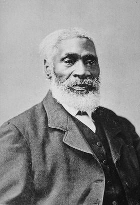 | Josiah Henson Museum of African-Canadian History | |
 | Aboard the Underground Railroad | |
| Canada's Historic Places The Canadian Register of Historic Places (CRHP) is Canada's definitive source of information on more than 13,000 historic places. | ||
 The solid blue line is the Canada-US border
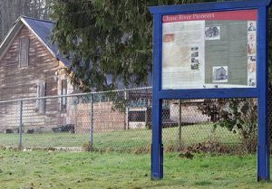